

As a child I was always drawn to books that had maps in their end papers – to guide the reader around the locations mentioned in the book or the travels of the protagonists. The maps were a kind of gimmick really to help younger readers to keep track of the story in some way – or bring the places and background information to life.
The Winnie-the-Pooh books had just such a map of The Hundred Acre Wood; the artist, E. H. Shepherd also drew the map for the Wind in the Willows by Kenneth Graeme. Kipling’s Jungle Book had a map in there too, as did C. S. Lewis’ Chronicles of Narnia and the iconic endpapers of Tolkien’s The Hobbit and epic Lord of the Rings series.
As well as helping the younger reader the maps conveyed something that perhaps the words couldn’t. Words can describe a person, a place or a feeling but are less well adept at explaining the relationship of one place with another. After all, the ‘100 Aker Wood’ (sic) is a pretty limited explanation of a place whilst the map tells us much more about who belongs where and perhaps relative distances between places.
Growing up my Dad always encouraged me to read a map. To know where I was and where I thought I would like to go. To plan a route and to understand the landmarks along the way, the milestones if you will. To recognise quickly if I’d made a wrong turn. Looking back, I see that this wasn’t just about getting from A to B, this was a life skill.
Yes, he let me read the map on family holidays (we had a camper van for road trips across the UK and Europe) and importantly, to plan the next day’s route the night before. It all made sense. At the same time, it wasn’t a strict, rigid route or regime as we were always going to places we’d never been before and that in itself was different and exciting. It was exploration. It was as spontaneous day to day as it might have been heading off in a random direction but remember we didn’t have a credit card, ATMs for extra cash, smart phones or a sat nav. No Google either.
We had what we had and planning the route didn’t detract from the thrill of places new or picking a new route mid-morning just because the Michelin Map had put a green edge on the road. Any excuse to take a detour off a dull main road was taken.
But in any case, these were the days when if you did plan to travel around a European country, you’d phone up the relevant tourist board office in London beforehand and they’d send you an envelope stuffed with glossy brochures advertising places and events that year together with a whole-country road map and maybe a camping/campsite map too. This was gold dust when it came through the post, you could start planning straight away.
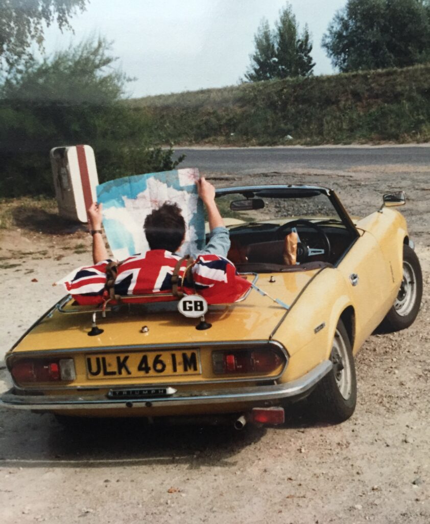
Famously in 1986, aged 21, I took myself and a friend across North West France using only such a whole-scale map (it’s in the picture) and a reprint of a 1940s Michelin map which apart from being four decades out of date, had parts of it obscured by markings of the Allied advances after D-Day. All this in a ten-year-old Triumph Spitfire with a toolkit for when it would go wrong. 250 miles a day with no power steering AND no servo assist on the brakes was actually physically exhausting! But exploring like that? That was living.
NEWSLETTER SIGN-UP
subscribe
Sign up here for all the latest updates and news from Absurvd.com.